See how far
you've explored.

WAU paints a colored trail along your path as you move: driving, cycling, or walking. Every road trip and morning run becomes a visible part of your story.

Free, no sign-up Works offline No ads, no tracking Anonymous community places
QR code linking to getwau.app/get

On a computer? Scan this to go straight to the right store.

Your journeys,
painted on the map.

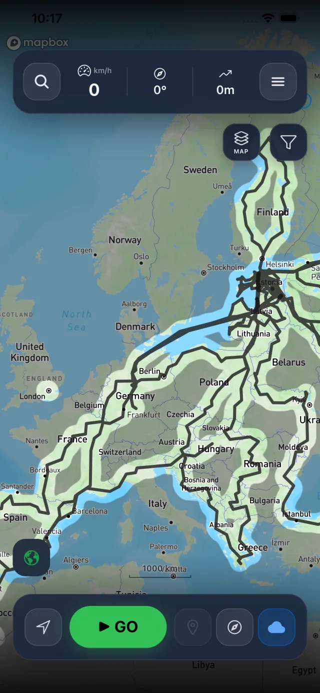
Hit record and go. As you drive, cycle, or walk, WAU draws a colored trail along your route — your personal fog of exploration. Over time, your map fills up with everywhere you've been.

The blank spots show where you haven't explored yet. That's where your next adventure is. Queue up to 10 destinations as waypoints and let WAU guide you through them one by one.

Save the spots worth remembering, add photos, share them with friends by QR code, and watch your progress build across continents. Import old tracks from other apps and they join the map too.

More than a line on a map

Everything runs on your phone. Nothing needs an account.

Places, yours and everyone's

Long-press the map to save a spot, or add one by search, coordinates or a friend's QR code. Attach photos so you remember what it actually looked like, and group and categorise them however you like.

Any of them can become public. Tap Make Public and, after a moderator review, it joins the campsites, beaches and viewpoints other explorers have shared — published anonymously, with nothing tying it to you. Load theirs by panning to where you're headed and tapping the cloud button; they are never fetched behind your back.
Levels, badges & quests

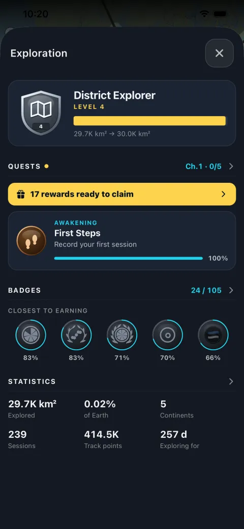
Earn badges for distance walked, area uncovered and altitude climbed, plus hidden ones you'll have to stumble into. Follow the quest line chapter by chapter, keep a daily streak, and share any badge as a card.

Collect POIs — turn a trail into a race

One person builds a course out in the wild: drop points as you drive, mark a Start and a Finish, and sort the rest into your own categories — easy, soft mud, very muddy — each worth points you decide. Then put a rotating QR code on your screen. Everyone playing scans it and the whole course lands on their phone. No internet, no accounts, nothing sent anywhere.

The clock starts when a player reaches the Start and points are collected as they drive past. Closing the app doesn't pause it. At the Finish they get a QR code of their own; whoever built the game scans it and they appear on the Hall of Fame, ranked by points, then time, then by who took on the harder ground. The drive itself is saved as an ordinary track, painted onto their map like any other.

Filter by date

Show only what you explored in a chosen period. Tracks and fog both follow the filter, so you can replay a single trip, or a single summer, without the rest of the map in the way.

Satellite & night map

Switch the basemap from the layer button: standard, satellite imagery, or a dark night mode for evening drives. Pick your own fog colour while you're at it.

Split expenses

Travelling as a group? Keep a shared tab for the trip, in any currency. WAU works out who owes whom and settles up, and it rides along in your backups.

A map that fills itself in

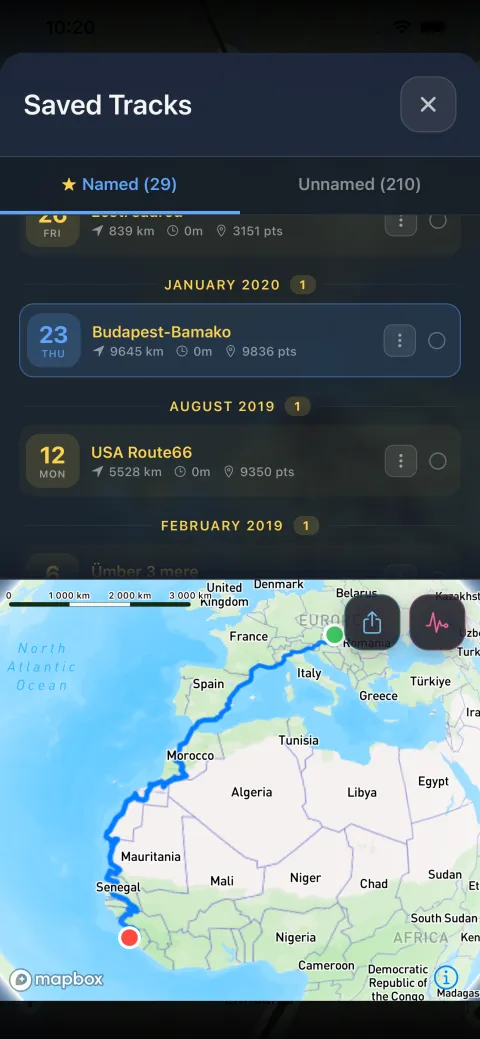
The Saved Tracks list grouped by month, over the map of a drive from Budapest to Bamako
Every track you've recorded
The Exploration screen: explorer level, the current quest chapter, badges closest to earning, and totals
Levels, badges & quests
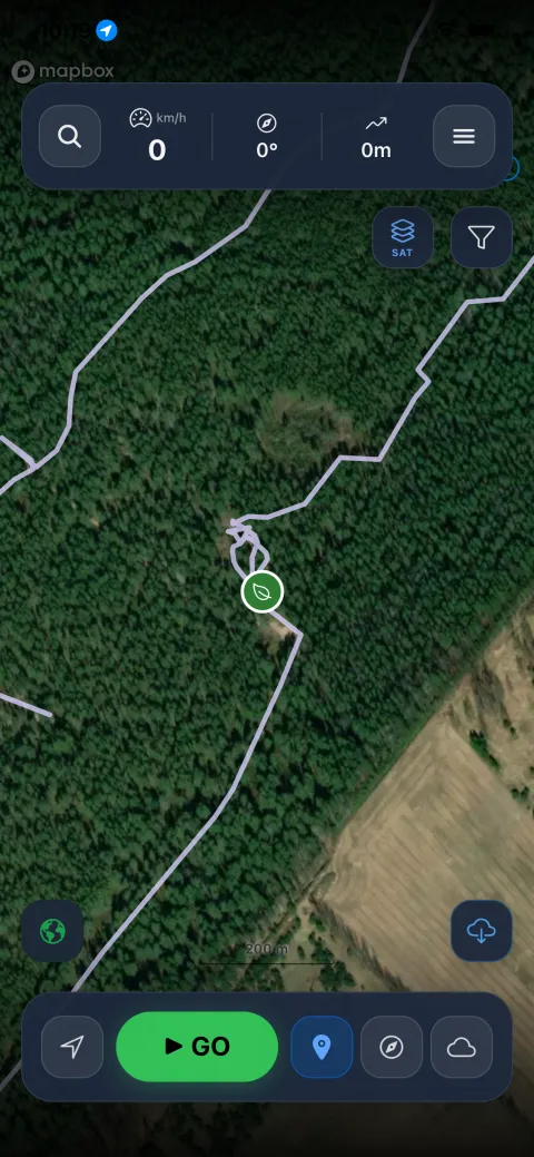
Satellite imagery with a recorded trail following a track through dense forest to a saved place
Satellite, down to the track
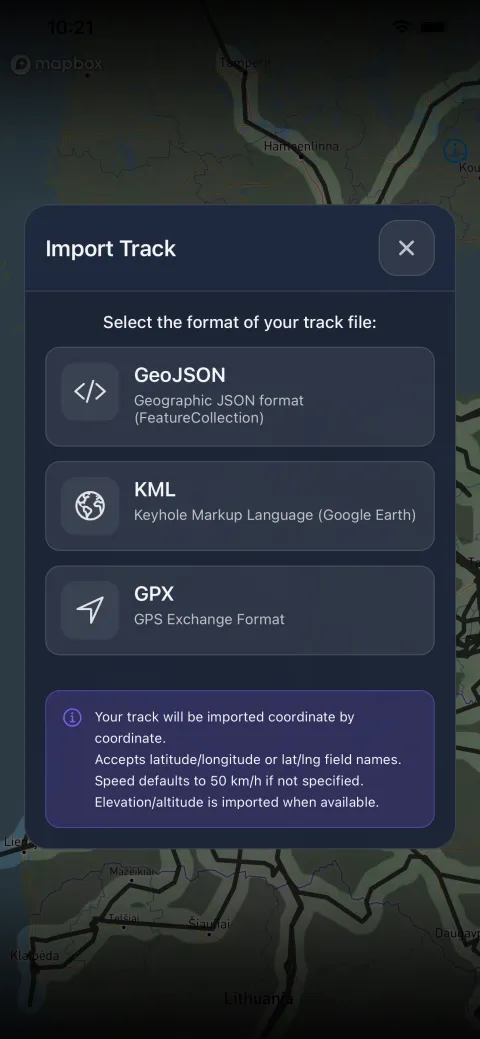
The Import Track dialog offering GeoJSON, KML and GPX, over a map of already-imported routes
Import GPX, KML & GeoJSON

Your map stays yours

No account, no analytics, no ads. WAU never asks who you are, and nothing leaves your phone unless you deliberately send it.

Stays on your device

  • Recorded tracks and explored fog
  • Saved places and their photos
  • Statistics, badges and streaks
  • Split-expense groups and settlements
  • Backups you make yourself

Sent only when you choose

  • A place you tap “Make Public” on: its name, location, category, description and the photos you attached
  • A comment or report you write on a public place
  • The map area on screen, at the moment you tap to load public places

Each is handled on its own: nothing is kept alongside it that links it back to you, your device, or the rest of your map. Full detail in the privacy policy.

Frequently asked

Everything you need to get the most out of WAU.

When you tap the record button, WAU uses your phone's GPS to trace your route. A colored trail is drawn along your path on the map, like a fog that reveals where you've been. The more you move, the more of the map you uncover.

Yes. WAU keeps recording when the app is minimized or your screen is off. That said, keeping the app in the foreground gives you the best GPS accuracy and more detailed trails. Background recording is great for longer trips where you don't need to watch the screen.

For the best experience on Android, WAU needs:

Location “Allow all the time” — so recording continues in the background. Settings → Apps → WAU → Permissions → Location → Allow all the time.

Battery optimization disabled — Android may stop background apps to save power. Settings → Apps → WAU → Battery → Unrestricted (or “Don't optimize”). Exact steps vary by manufacturer.

Without these, Android may pause or stop recording while the app is in the background.

Grant “Always” location permission when the app asks. That's what allows background recording. iOS handles battery management itself, so no extra settings are needed.

Recording and exploration tracking work completely offline. Your GPS tracks and fog are saved locally. You only need a connection to load base map tiles for areas you're viewing for the first time; once loaded they're cached. Public places also need a connection, and only when you tap to load them.

Campsites, beaches, viewpoints and other spots shared by WAU users around the world. Pan the map to where you're headed and tap the cloud button to load them for that area. They're never fetched in the background.

To share one of your own, open a saved place and tap Make Public. A moderator reviews it, then it's published anonymously. Nothing links it to you or your device.

Sharing is one-way: an approved place can't be made private again, and removing it later takes a deletion request. Think of it as a gift to other explorers.

The quickest way is straight from the map: press and hold anywhere on it, then tap Save Place. The spot is added to My Places without leaving the map.

You can also open the menu, tap My Places, then + New: Search for an address or place name, enter exact Coordinates, save your Current location, or Scan QR from a friend.

You can attach photos to any place, and organise them into groups and categories.

Open My Places, tap the place, then tap Share. That generates a QR code holding the place details.

Your friend opens WAU, goes to My Places → + New → Scan QR, and scans it. The place lands in their collection instantly. No internet required.

A treasure hunt you build yourself, for driving off-road with friends. Open Menu → Games → Collect POIs game.

One person builds the course: tap Start adding places and drop points from the map as you drive. Mark one as the Start and one as the Finish, and sort the rest into your own categories — easy, soft mud, very muddy — each worth points you decide.

Everyone else scans the game code and drives it. The clock starts at the Start point and stops at the Finish, and points are collected automatically as they pass.

By QR code, phone to phone. Tap Show the game code and a rotating code appears — a course is too big for one QR, so it cycles through a few frames. The other phone scans it until it has every frame, then the whole course is loaded.

No internet, no accounts, no server. Nothing about your game leaves the two phones. It works in a forest with no signal, which is where you'll be using it.

Results come back the same way: when a player finishes, their phone shows a code that the person who built the game scans.

To collect points, yes — points are only collected while the map is on screen. You'll be watching it anyway to find the route to the next one.

Your track keeps recording in the background exactly as it always does. Pocket the phone and the drive is still saved; you just won't bank any points until you're looking at it again.

Most points wins. Level on points, the faster run wins. Level on both, it goes to whoever took on the harder ground — a run scoring 50 + 10 beats one scoring 30 + 30. If that still ties, whoever finished first.

Anyone who ran out of time or gave up ranks below everyone who finished, however many points they collected.

Every game has a time limit that ends it by itself, and closing the app doesn't pause the clock — so heading home early costs you the run rather than freezing it.

Open Statistics and you'll find Quests and Badges tabs next to your numbers. Badges are earned for distance walked, area uncovered, altitude climbed, places saved and more, with a few hidden ones you'll have to stumble into.

The quest line runs in chapters, each with its own objectives. Finish one and tap Claim to collect its seal. Explore on consecutive days to build a streak. Miss one and there's a little grace before it resets.

Yes — GPX, KML and GeoJSON files from hiking apps, fitness trackers, or anything that exports GPS tracks. Menu → Import Track, pick your file, and it appears on your map and counts toward your exploration progress.

Settings → Backup & Restore writes a single file with your tracks, fog, places, photos, expenses and settings. Move that file to the new phone and restore it there.

Because nothing is stored in a cloud for you, this backup is your safety net, worth making before you switch devices.

Your tracks, fog, saved places, photos and statistics are stored only on your device. WAU has no user accounts, collects no analytics, and never uploads your location history.

What does leave is what you deliberately send: a place you publish with Make Public, a comment or report you write on a public place, and the map area on screen when you tap to load public places. Each is handled on its own, with nothing kept alongside it that links it back to you.

Love WAU?

WAU is built with passion and available for free: no ads, no tracking, no subscriptions. Donations pay for the servers and the moderation behind public places.

Support WAU

You can also support WAU from inside the app, under menu → About → Support WAU.

Ready to explore?

Free download. No sign-up required.